
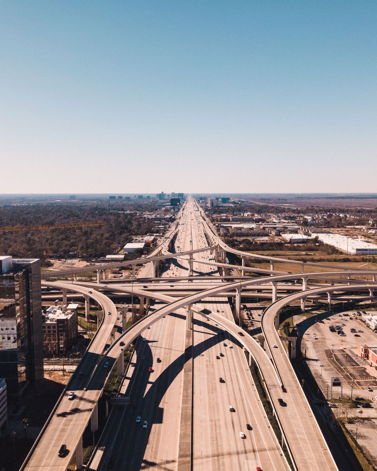
Satellite Town Ring Road (STRR): The Complete Route, Status, and Real Estate Guide

Published: 23 August 2026 | By L K Monu Borkala, CEO & Founder, OneCity Property — 15 years of property consultancy experience and over 20 years in marketing and management at OneCity Technologies Pvt. Ltd.
Satellite Town Ring Road (STRR): The Complete Route, Status, and Real Estate Guide
Quick answer: The Satellite Town Ring Road (STRR, officially NH-948A) is a 280.8 km access-controlled expressway under construction by NHAI, encircling Bengaluru and connecting 12 satellite towns - Dobbaspet, Doddaballapura, Devanahalli, Sulibele, Hoskote, Sarjapura, Attibele, Anekal, Tattekere, Kanakapura, Ramanagara, and Magadi - before extending on into Hosur, Tamil Nadu. As of August 2026, roughly 82 km is fully operational and tolled (Dobbaspet to Hoskote), a further 21 km stretch to the Tamil Nadu border has been delayed but is targeting mid-2026 completion, and a critical 56 km stretch through the eco-sensitive zone of Bannerghatta National Park has been stuck on forest clearance for years with no confirmed restart date. This guide walks the full route, every phase's real status, and what it in practice means for property along each stretch - not the "ring road is coming, buy now" version.
If you've read our STRR vs PRR guide, you already know the two projects get conflated constantly despite being run by different agencies at different scales. That piece covers the distinction. This one goes deeper on STRR specifically - every phase, every town, the Bannerghatta holdup nobody explains clearly, and an honest read on what's truly operational versus what's still a plan on paper.
What STRR Actually Is
STRR is a National Highways Authority of India (NHAI) project, built under the Bharatmala Pariyojana programme and formally designated NH-948A (with some realignment work carried under NH-648). It was first conceptualised by the Karnataka state government back in 2005, stalled for over a decade on land acquisition and funding, and was revived once NHAI took over execution after the road was notified in 2017. Prime Minister Narendra Modi formally launched the project in June 2022, and the first major stretch - Dobbaspet to Hoskote - opened on 11 March 2024.
The full corridor spans 280.8 km of the NH-948A designation itself, though the broader project description you'll see in some sources - 288 km - includes an additional 45 km stretch that falls across the border in Tamil Nadu, en route to Hosur. The project covers a declared planning area of 1,019 sq km and, per NHAI's own project documentation, touches more than 330 villages along its alignment. Total estimated cost sits at ₹17,000 crore, funded primarily through NHAI under the Hybrid Annuity Model, with some sources indicating a roughly 60:40 NHAI-to-Karnataka-government cost split for specific components.
The planning authority governing land use and approvals along the corridor is STRRPA - the Satellite Town Ring Road Planning Authority - a detail worth knowing because it shows up directly on RERA filings for projects in the corridor. It's a truly useful term to search for if you're trying to verify whether a specific project or layout has proper approval standing in the STRR zone.
The Route: Every Town STRR Connects
Starting from the northwest and running clockwise around the city, STRR connects: Dobbaspet (also spelled Dabaspete) → Doddaballapura → Devanahalli → Sulibele → Hoskote → Sarjapura → Attibele → Anekal → Tattekere → Kanakapura → Ramanagara → Magadi → back toward Dobbaspet, with the Hoskote-side stretch continuing onward to Hosur across the Tamil Nadu border. This is the 12-town list NHAI's own project documentation and the most recent 2026 coverage consistently cite - treat any list that differs meaningfully from this with some caution, since older, pre-2024 sources sometimes describe an earlier, since-revised alignment.
The Network at a Glance
| Stretch | Length | Status (August 2026) |
|---|---|---|
| Dobbaspet - Doddaballapur - Hoskote | ~82 km | Operational since March 2024, tolled |
| Hoskote - Tamil Nadu border (toward Hosur) | ~21 km | Delayed from Feb 2025; targeting mid-2026 |
| Bannerghatta National Park stretch (Phase 2) | ~56 km | On hold - forest clearance pending, no confirmed restart |
| Western packages (Somakkanamutta - Kunigal - Thattekere - Magadi direction) | ~144 km combined (per most recent official statement) | Mixed - some packages complete, others targeting Sept - Nov 2026 |
Add it up and roughly 102.6 km becomes truly operational once the Hoskote-Tamil Nadu border stretch clears its final hurdle - out of a 280.8 km total. That's a little over a third of the ring, concentrated on the eastern and northeastern side of the city. The rest remains a mix of "under active construction with a real date attached" and "on hold indefinitely," and this guide is built specifically to help you tell those two categories apart for whichever stretch matters to you.
The Bannerghatta National Park Story: Why 56 km Has Been Stuck for Years
This is the single most important piece of context missing from most STRR coverage, and it directly explains why the southern stretch of this ring road has made so little visible progress despite years of "coming soon" framing in property marketing.
NHAI's original STRR alignment planned to route through the eco-sensitive zone (ESZ) of Bannerghatta National Park, specifically the stretch from kilometre 95.525 to kilometre 138.0 - a 56 km section that officials have long referred to as Phase 2. Because this alignment cuts through protected forest land, it requires far more than standard highway clearances. The design calls for an 8.1 km elevated highway through the park's most sensitive stretch - roughly 3.85 km through the core zone and around 2 km through the buffer zone - built on a 28.5-metre right-of-way, and it requires formally diverting approximately 11 hectares of forest land from the core zone and 5.7 hectares from the buffer zone.
That land diversion needs sign-off from the Forest Conservation Authority under India's forest conservation laws, plus environmental clearance from the Ministry of Environment, Forest and Climate Change (MoEFCC). As of the most recent reporting available, MoEFCC had issued terms of reference for the environmental assessment, but final forest diversion approval had not been granted. NHAI has publicly confirmed the hold. There is no confirmed restart date for construction on this specific stretch.
Here's what makes this truly consequential rather than a routine bureaucratic delay: this exact holdup has been publicly known and reported since at least 2023-2024, and it remains unresolved as of this guide's publication in mid-2026. NHAI's own regional officers have said publicly that Phase 3 (the western packages) would be taken up ahead of Phase 2 specifically because of this holdup - meaning NHAI itself has effectively deprioritised this stretch rather than treating it as imminent.
If you're evaluating property in Anekal, Kanakapura, or anywhere along the southern arc of STRR's planned alignment specifically because of this ring road, the honest picture is that you're waiting on an environmental clearance process with no announced timeline - not a construction delay with a revised date attached, which is a meaningfully different risk profile.
A Broader Funding Concern Worth Knowing
Separate from the Bannerghatta-specific holdup, there's a wider financing question worth flagging in practice. Reporting from around October 2025 indicated that the central government had suspended further disbursements under remaining phases of the broader Bharatmala Pariyojana programme - the national highway scheme STRR is funded under - citing fiscal constraints. Where exactly STRR's still-unbuilt stretches sit relative to that broader pause isn't fully clear from public reporting, and it's the kind of detail that's easy for optimistic property marketing to simply omit. We're flagging it here because a truly complete picture of STRR's risk profile has to include the financing environment the project sits in, not just the physical construction status of any one stretch.
What's Actually Confirmed and Operational Right Now
Stripping away the parts still in question, here's the truly solid ground.
The Dobbaspet - Doddaballapur - Hoskote stretch (approximately 82 km) has been open and tolled since March 2024. This is a real, functioning, revenue-generating highway - the strongest evidence anywhere on the STRR alignment that the project truly delivers once a stretch clears land acquisition and construction. The Doddaballapur-Hoskote segment specifically (34.15 km) opened with toll collection starting in November 2023, running at four lanes with a stated capacity of 10,000 passenger car units per hour.
Toll rates on this operational stretch give a useful real-world benchmark: on the Doddaballapur-Hoskote section, light motor vehicles pay ₹70 for a single trip and ₹105 for a same-day return, while buses and trucks pay ₹240 and ₹360 respectively. Two-wheelers are exempt entirely. The Dobbaspet-Hoskote stretch as a whole (81.6 km) runs roughly ₹185 single trip and ₹275 return for cars - working out to about ₹2.20 per kilometre for a single journey. This became Karnataka's first fully boothless toll plaza - vehicles are scanned via number plate and FASTag within 50 metres of the plaza, with no manned counters at all, an early signal of the project's technical execution quality even where its land-acquisition and environmental clearance timeline has struggled.
The Hoskote-to-Tamil Nadu-border stretch (approximately 21 km) is the most concrete near-term addition to the operational network. It was originally targeted for a February 2025 completion, missed that by roughly sixteen months, and as of the most recent reporting is projected to open around June 2026, held up specifically by a pending railway overbridge near Lingadeeramallasandra awaiting South Western Railway clearance. Once this stretch opens, the total operational STRR length rises to roughly 102.6 km.
The western packages - covering the Somakkanamutta-Kunigal, Kunigal-Thattekere, and Thattekere-Bagganadoddi stretches, broadly the Mysuru Road and Magadi Road direction - are, per NHAI's own regional leadership, being executed ahead of the stalled Bannerghatta stretch specifically to keep overall project momentum visible. A recent statement from the Union Minister for Road Transport and Highways in the Rajya Sabha indicated four of six major packages already complete, with the remaining two targeting September and November 2026 - though as with much of this project, treat any specific month-level date as the current best estimate rather than a locked commitment, given the project's track record on the eastern stretches.
Real Estate Impact, Town by Town
STRR's effect on property isn't uniform across its 280.8 km - it depends entirely on which specific stretch serves a given town, and whether that stretch is the operational eastern arc, the stalled Bannerghatta section, or one of the western packages still working through construction. Here's the honest picture for the towns generating the most genuine buyer interest.
Devanahalli
Devanahalli sits at the genuine intersection of two independent growth stories - Kempegowda International Airport and the STRR corridor - and it's worth separating the two rather than crediting STRR alone. The airport, the KIADB Aerospace Park, and the broader BIAL IT Investment Region are already real, operating anchors independent of any ring road. STRR adds a second dimension: once fully connected, Devanahalli transitions from a location primarily accessed via NH-44 into a genuine ring-road node, with more direct routes to Hoskote, Doddaballapur, and eventually the southern and western stretches of the ring. Our dedicated guides on plots for sale in Devanahalli under ₹50 lakhs and why Devanahalli is a strong plot investment destination both go deeper on current pricing and layout-specific due diligence for this corridor.
Hoskote
Hoskote sits directly on STRR's operational stretch - the Dobbaspet-Hoskote and Doddaballapur-Hoskote sections that have been open and tolled since 2024 - which makes it the single clearest example of STRR's real, already-realised impact rather than a future promise. Hoskote also sits at the eastern end of the delayed Tamil Nadu-border stretch, meaning it's simultaneously benefiting from confirmed operational road access today and waiting on the next segment's completion for the fuller ring-road effect. Our Hoskote plot investment guide covers the specific pricing and appreciation data for this corridor in depth.
Budigere Cross
Budigere Cross isn't directly on the STRR alignment itself, but it sits close enough to the corridor's eastern influence zone - near Hoskote and the broader NH-75 belt - that STRR's eventual completion truly factors into its medium-term growth case, alongside the more immediate NH-75 widening and the KIADB Aerospace Park's employment growth. Treat STRR here as a genuine secondary tailwind rather than the primary reason to buy - the area already has an independent growth story worth evaluating on its own terms, covered in our Budigere Cross villas and plots guide.
Sarjapur and the Southeastern Stretch
Sarjapur sits along STRR's planned southeastern alignment, in the general direction of the stalled Bannerghatta stretch rather than the operational eastern arc. This is an important distinction: Sarjapur's existing growth case is overwhelmingly driven by its IT-corridor proximity - Wipro, RMZ EcoWorld, and the broader ORR tech belt - not by STRR, and given the honest status of the Bannerghatta-area stretch covered above, any STRR-specific premium being marketed on Sarjapur-adjacent land right now deserves real scrutiny. Our Sarjapur Road plot investment guide covers the IT-driven case in detail, separate from any ring-road timeline.
Kanakapura, Anekal, and the Southern Arc
These towns sit most directly along the stalled Bannerghatta National Park stretch - the 56 km section with no confirmed forest-clearance timeline. This is truly the part of the STRR story where the most patience is warranted. Land here may carry long-term upside once (or if) the environmental clearance process resolves, but treat any near-term "STRR is coming" pricing premium in this specific corridor with the most caution of anywhere on the ring, given how long this particular stretch has already sat unresolved.
Doddaballapur, Magadi, and the Western Arc
This is where the western packages - the ones NHAI has prioritised ahead of the stalled Bannerghatta stretch - are actively progressing, with several packages already complete and the remainder targeting completion through late 2026 per the most recent official statements. This makes the western arc a truly more credible near-to-medium-term STRR thesis than the southern Bannerghatta-adjacent stretch, though still meaningfully earlier-stage than the fully operational eastern arc through Hoskote.
A Framework for Evaluating Any "Near STRR" Claim
Given how differently each stretch of this 280.8 km ring is actually progressing, the single most useful thing you can do with any STRR-based property pitch is ask exactly which segment the property actually sits near, and cross-reference that against this guide's status table. "Near STRR" said about a Hoskote property and "near STRR" said about a Kanakapura property are not remotely the same claim in terms of construction confidence, even though both are technically true statements about proximity to the same named project.
Our broader plot investment guide and BMRDA approval verification guide both apply this same discipline - confirmed, funded, under-construction infrastructure deserves real weight in a decision; announced or stalled infrastructure deserves genuine scepticism regardless of how confidently it's marketed.
What STRR Actually Connects To
Part of what makes STRR truly significant for logistics and, by extension, industrial and warehousing real estate along its route is the sheer density of highway connections it's designed to intersect. NHAI's own project documentation describes STRR as linking 8 state highways and 6 national highways along its alignment - meaning it functions less as a single point-to-point road and more as an orbital distribution network, letting freight and inter-city traffic move between any two of those highways without ever entering Bengaluru's city core.
Among the most consequential of these connections: NH-44 (the Bengaluru-Hyderabad corridor, also called Bellary Road, which passes directly through the airport approach at Devanahalli), NH-48 (the Bengaluru-Tumakuru direction), NH-75 (Old Madras Road, running through Hoskote), and the newer Bengaluru-Chennai Expressway, which STRR connects to via a trumpet interchange near the Tamil Nadu border stretch. For industrial and logistics-focused land near Dobbaspet, Hoskote, or the Bengaluru-Chennai Expressway junction specifically, this multi-highway connectivity is arguably a stronger and more immediate value driver than STRR's residential-commute framing, since freight operators can start using operational stretches today regardless of when the full ring completes.
STRR vs PRR vs ORR: Three Rings, Not One
Bangalore property conversations regularly blur STRR together with the Peripheral Ring Road (PRR) and the older, already-built Outer Ring Road (ORR) - three truly different projects at three different distances from the city core, executed by different agencies on different timelines. The short version worth holding in mind throughout this piece: ORR is the innermost, fully-built ring that already anchors Bangalore's IT corridor (Marathahalli, Bellandur, and the broader eastern tech belt sit directly on it). PRR is a planned middle ring, roughly 65-75 km, run by the Bangalore Development Authority rather than NHAI, sitting between ORR and STRR. STRR is the outermost ring - by far the largest at 280.8 km, run by NHAI under a national highways mandate, and designed explicitly to bypass the city entirely rather than elevated intra-city movement.
The practical implication: a property described as benefiting from "the ring road" without specifying which one could mean three meaningfully different things, at three meaningfully different distances from the city, on three meaningfully different construction timelines. Always confirm which specific project - and which specific stretch of that project - a connectivity claim actually refers to.
A Brief History: Two Decades From Concept to Concrete
STRR's timeline is worth understanding because it explains the scepticism this guide applies to any single announced date. The Karnataka state government first conceptualised the project in 2005. It then stalled for well over a decade - land acquisition disputes and funding constraints kept it largely on paper through the 2010s. The project gained real momentum only after being folded into the central government's Bharatmala Pariyojana programme around 2017, when NHAI formally took over execution and the road was notified as NH-948A.
Prime Minister Modi launched the project in June 2022. The first major stretch - Dobbaspet to Hoskote - opened less than two years later, in March 2024, which is a truly fast execution pace by Bangalore infrastructure standards once land and funding actually aligned. That's the pattern worth internalising: STRR moves quickly once a specific stretch clears land acquisition and environmental hurdles, and moves not at all - sometimes for years - when it doesn't. The Bannerghatta stretch is the clearest current example of the latter.
The Map
Here's the full ring laid out schematically, colour-coded by genuine construction status rather than by phase number, since phase numbering has been described inconsistently across different NHAI statements over the project's history.
Schematic representation - town positions indicate sequence around the ring, not exact geographic bearing or distance. Always verify current alignment and construction status through NHAI's official channels for any location-specific decision.
Terms Worth Knowing Before You Read Any NHAI or Developer Claim
A short glossary, since STRR coverage - official and marketing alike - leans on terms that aren't always explained.
NHAI - National Highways Authority of India, the central government body executing STRR under the Bharatmala Pariyojana programme. Distinct from BDA (Bangalore Development Authority), which executes the separate PRR project.
STRRPA - Satellite Town Ring Road Planning Authority, the body governing land-use approvals within the STRR corridor's declared planning area. Worth checking for on any project's RERA filing if the project claims STRR-corridor approval standing.
ESZ (Eco-Sensitive Zone) - the buffer area around a protected forest or wildlife area, in this case Bannerghatta National Park, where construction requires additional environmental and forest clearances beyond standard highway approvals. This is the specific designation driving the 56 km Bannerghatta stretch's extended hold.
Hybrid Annuity Model (HAM) - the funding and execution structure under which STRR operates, where the government and a private concessionaire share construction cost and the concessionaire recovers investment partly through toll revenue and partly through annuity payments from NHAI over time.
Right of Way (RoW) - the total width of land reserved for the road corridor, including the carriageway itself plus verges and service infrastructure. STRR's standard RoW runs around 45-52 metres in most stretches, narrowing to the specific 28.5-metre figure cited for the elevated Bannerghatta section.
Access-controlled expressway - a highway design where entry and exit happen only at designated interchanges, rather than through continuous local access points. This is what allows STRR to support 100 kmph design speeds and function as genuine bypass infrastructure rather than just a wider arterial road.
Which Stretch Actually Matches Your Situation
Rather than treating "near STRR" as one uniform factor, here's how to think about it based on what you're actually trying to do.
If You're a Freight, Logistics, or Warehousing Buyer
The operational Dobbaspet-Hoskote stretch is truly valuable to you today, not eventually. STRR's multi-highway connectivity - linking NH-44, NH-48, and NH-75 without routing through city traffic - is precisely the kind of infrastructure that changes freight economics immediately upon opening, and this stretch has been open since 2024. Land near Dobbaspet specifically benefits from proximity to the planned Multi-Modal Logistics Park, adding a second institutional anchor to the freight thesis beyond the highway itself.
If You're an End-User Buying to Live Near the Airport
Devanahalli's growth case stands on its own - the airport, KIADB Aerospace Park, and BIAL IT Investment Region are real, current employment anchors independent of STRR. Treat STRR as a genuine connectivity bonus once the ring fully develops, not as the reason to buy - the airport-driven case is covered in full in this guide's town-by-town section above.
If You're Chasing Appreciation on the Operational Eastern Arc
Hoskote is the clearest example of STRR's realised, not promised, impact - a town sitting directly on two years of operational, tolled highway. Much of the "STRR premium" that's easiest to defend with actual evidence sits here rather than on stretches still awaiting construction or clearance.
If You're Considering the Southern Arc (Anekal, Kanakapura, Tattekere)
Be the most patient here of anywhere on the ring. The Bannerghatta stretch serving this arc has no confirmed forest-clearance timeline, and this guide's research found no evidence the holdup is close to resolving. Any land in this specific stretch should be evaluated on its own independent merits - existing road access, other nearby infrastructure, agricultural or alternate-use value - rather than on an STRR completion date nobody can currently give you with confidence.
If You're Weighing the Western Arc (Doddaballapur, Magadi, Ramanagara direction)
This is the ring's genuine medium-term opportunity - meaningfully more credible than the southern arc, since NHAI has explicitly prioritised these packages ahead of the stalled Bannerghatta stretch, with several already complete and the remainder targeting late 2026. Not yet as proven as the fully operational eastern arc, but a considerably more defensible near-term bet than the south.
Deep-Dive: What's truly There Today at Five Key Towns
Independent of STRR's own timeline, here's what actually exists at the towns generating the most buyer interest along this corridor.
Devanahalli
| Category | What's truly There Today |
|---|---|
| Anchor Institution | Kempegowda International Airport - truly one of India's busiest and fastest-growing airports |
| Employment | KIADB Aerospace Park (Boeing India, Airbus Technology Centre, Shell R&D all present), BIAL IT Investment Region |
| Road Infrastructure | NH-44 signal-free corridor from Hebbal, reducing travel time to Manyata Tech Park and Hebbal to roughly 25-35 minutes |
| Metro Access (Future) | Namma Metro Blue Line Phase 2B, under active construction - covered in our full Namma Metro guide |
Hoskote
| Category | What's truly There Today |
|---|---|
| STRR Status | Sits directly on the operational Dobbaspet-Hoskote stretch - open and tolled since 2024, the strongest current evidence of STRR's real impact anywhere on the ring |
| Existing Road Access | NH-75 (Old Madras Road), long-established as an East Bangalore industrial and residential corridor independent of STRR |
| Industrial Base | Established logistics parks and warehousing facilities, predating STRR and adding independent employment demand |
| Suburban Rail (Future) | Serves as a Kanaka Line reference point on the Bengaluru Suburban Rail Project - see our full suburban rail guide for that project's honest, separate construction status |
Doddaballapur
| Category | What's truly There Today |
|---|---|
| STRR Status | Sits on the operational Dobbaspet-Hoskote stretch, specifically the Doddaballapur-Hoskote segment tolled since November 2023 |
| Character | A historically significant textile and silk-weaving town, with genuine pre-existing commercial identity independent of the highway |
| Industrial Growth | Growing industrial estate presence, benefiting from the same NH-948A connectivity now open through the town |
Kanakapura
| Category | What's truly There Today |
|---|---|
| STRR Status | Sits along the stalled Bannerghatta National Park stretch - no confirmed construction timeline |
| Existing Connectivity | Kanakapura Road itself is an established, independently significant arterial corridor with its own residential growth story, separate from STRR entirely |
| Honest Assessment | Evaluate this location on Kanakapura Road's own established merits; treat STRR specifically as a genuine long-horizon bonus with real environmental-approval uncertainty attached |
Magadi
| Category | What's truly There Today |
|---|---|
| STRR Status | Sits on the western arc, among the packages NHAI has prioritised ahead of the stalled Bannerghatta stretch - meaningfully more credible near-term than the southern arc |
| Character | A historic town with its own established road connectivity via Magadi Road, predating STRR's western package construction |
| Honest Assessment | A genuine medium-term opportunity, though still earlier-stage than the fully operational eastern arc through Hoskote and Doddaballapur |
Two Stretches That Show Exactly What STRR Can and Can't Deliver Yet
Numbers and status tables only tell part of the story. Two specific stretches of this ring illustrate, in opposite directions, exactly what STRR means in practice right now.
Hoskote-Doddaballapur: What "Operational" Actually Looks Like
Before 2024, moving freight or commuting between Dobbaspet, Doddaballapur, and Hoskote meant navigating a patchwork of older state highways and local roads, with no dedicated access-controlled corridor connecting all three. Today, a truly modern, tolled, boothless-payment expressway does that job in a fraction of the time, running at design speeds of 100 kmph with automated FASTag scanning that doesn't require vehicles to stop. This is the part of STRR that has moved from promise to reality, and it's worth understanding concretely what that transition looked like: land acquisition completed, construction executed, tolling operational, all within roughly two years of the project's 2022 relaunch. When people talk about STRR's real potential, this stretch is the actual evidence behind that claim - not a projection.
Bannerghatta: What "Stuck" Actually Looks Like
Contrast that with the 56 km stretch through the Bannerghatta eco-sensitive zone. This section has been publicly discussed as a known holdup since at least 2023, with the same core blocker - forest diversion clearance - still unresolved as of this guide's publication in mid-2026. No amount of funding availability or contractor readiness moves this stretch forward until the Forest Conservation Authority and MoEFCC complete their review and grant diversion approval, and there is no public indication of when that might happen. This is truly different from a normal construction delay, where more money, more workers, or more political pressure can accelerate progress. Environmental clearance processes for protected zones don't respond to those levers in the same way, and treating this stretch as "coming eventually, just running late" understates how truly open-ended the timeline is.
Holding both of these realities simultaneously - real, delivered infrastructure on one stretch, truly stuck infrastructure on another, under the same project name - is the single most important mental model this guide can offer.
How STRR Fits Alongside Bangalore's Other Major Infrastructure
If you're weighing multiple infrastructure-driven property theses at once, here's how STRR's various stretches compare to the other major projects we cover in depth elsewhere on this site.
| Project / Stretch | Current Status | Confidence Level |
|---|---|---|
| Namma Metro Purple/Green/Yellow Lines | Fully operational | Highest - already delivered |
| STRR Dobbaspet - Hoskote | Operational, tolled since 2024 | Highest - already delivered |
| Namma Metro Pink/Blue Lines | Under construction, progressing | High - active, funded, tracked |
| STRR Hoskote - Tamil Nadu border | Delayed, targeting mid-2026 | Moderate-high - genuine progress, one confirmed blocker remaining |
| STRR western packages (Doddaballapur/Magadi direction) | Mixed - several complete, rest targeting late 2026 | Moderate - real progress, some execution risk remains |
| BSRP Mallige Line (suburban rail) | ~30% complete, re-tendering after contractor exit | Moderate - genuine progress, real execution risk |
| STRR Bannerghatta stretch (56 km) | On hold - environmental clearance pending, no timeline | Low - open-ended regulatory risk, not just delay |
| BSRP Sampige/Parijaata Lines (suburban rail) | Zero ground construction, still tendering | Low - plan stage only |
| Peripheral Ring Road (PRR) | Land acquisition ~60% complete for Phase 1 | Low-moderate - real government commitment, early execution stage |
Our Namma Metro guide and suburban rail guide, linked earlier in this piece, apply this same stretch-by-stretch, honesty-first framework to their respective networks. The consistent principle across all three: a single project name can span wildly different confidence levels depending on which specific segment you're actually evaluating, and treating an entire multi-decade, multi-hundred-kilometre project as one uniform status is exactly where buyer confusion - and bad pricing decisions - come from.
Pricing Along the Corridor: What the Range Actually Looks Like
Land pricing along STRR's various stretches varies enormously depending on proximity to the operational arc versus the stalled or still-developing stretches, and depending on whether the specific plot sits in an already-established micro-market or a truly peripheral, infrastructure-dependent one. Based on current listings and project pricing across the corridor:
| Corridor Segment | Typical Plot Pricing (₹/sq ft) | What You're Actually Paying For |
|---|---|---|
| Devanahalli town / NH-44 corridor | ₹6,000 - ₹9,000 | Airport proximity and aerospace employment, with STRR as a genuine bonus |
| Hoskote (on operational stretch) | ₹2,500 - ₹4,500 | DTCP-approved layouts pricing in already-realised STRR connectivity |
| STRR corridor, Doddaballapur Road | ₹3,000 - ₹5,000 | An infrastructure-arrival play - priced ahead of full corridor maturity |
| Sarjapur outer / Bannerghatta-adjacent stretch | Highly variable | Driven predominantly by IT-corridor proximity, not STRR given its stalled status here |
| Budigere Cross (STRR-adjacent, not on alignment) | ₹9,000 - ₹13,500 | Whitefield-adjacent IT corridor access, STRR as secondary tailwind |
The pattern worth internalising: pricing on the operational eastern stretch already reflects realised infrastructure value, meaning the easiest gains from STRR's completion there have likely already been captured. Pricing on the stalled southern stretch remains lower precisely because the market has, correctly, not yet priced in infrastructure that has no confirmed delivery timeline. Neither is automatically the better buy - it depends on whether you're purchasing for realised value today or truly speculative long-horizon upside.
Legal and Documentation Considerations Specific to National Highway Corridors
Buying land near a national highway project carries a few specific documentation checks that don't apply the same way to metro or state-road-adjacent property, worth understanding before you commit to anything near STRR's alignment.
Land acquisition award status. For any parcel truly close to the STRR alignment, confirm whether that specific survey number has already been through the land acquisition process (and compensated accordingly) or still sits outside the acquired corridor. NHAI's land acquisition proceeds under the National Highways Act, and awards are published - verify a specific parcel's status directly rather than assuming proximity alone tells you anything definitive.
Setback and Right of Way encroachment. STRR's standard right of way runs roughly 45-52 metres across most stretches. Any construction or existing structure within that reserved corridor width is technically an encroachment on land NHAI has rights to, regardless of how long it's stood there. Verify a property's actual boundary against the highway's declared alignment plan before assuming a structure's current footprint is secure long-term.
Access point restrictions. Because STRR is an access-controlled expressway, direct property access onto the highway itself isn't available except at designated interchanges. A property's actual road connectivity - whether via a service road, an existing local road, or a formal interchange approach - matters more for practical daily use than raw proximity to the highway's centerline.
STRRPA layout approval, separate from BMRDA or BDA approval. As covered earlier, STRRPA governs land use specifically within STRR's declared planning area. A layout carrying standard BMRDA approval outside this specific jurisdiction isn't the same as one carrying STRRPA approval within it - confirm which authority actually governs a specific parcel before treating any approval stamp as sufficient.
How STRR Compares to Other Indian Ring Roads
For context on what a project at this scale truly means, it's worth briefly situating STRR against comparable ring-road projects elsewhere in India. Delhi's Eastern and Western Peripheral Expressways, completed years ago, offer the clearest domestic precedent for what a fully operational satellite-town ring road does to surrounding land values - sustained, multi-year appreciation concentrated most heavily around interchange points and towns with independent employment anchors, rather than uniform appreciation across the entire corridor. Hyderabad's Regional Ring Road, still largely in planning as of 2026, offers a useful comparison in the opposite direction - a project that, like STRR's stalled stretches, has faced its own land acquisition and environmental friction, illustrating that STRR's specific challenges aren't unique to Bangalore or to this project's execution team, but rather a common pattern for peripheral ring-road infrastructure at this scale across India.
The practical takeaway from these comparisons: fully delivered ring-road stretches truly do drive sustained value, concentrated most strongly where the ring intersects existing employment or transit infrastructure - precisely the pattern already visible on STRR's own operational Hoskote stretch. Stalled or delayed stretches, meanwhile, are the norm rather than the exception for projects at this scale, which is useful context for calibrating how much weight to place on any single announced completion date.
The Multi-Modal Logistics Context
STRR's connection to the proposed Multi-Modal Logistics Park at Dobbaspet is worth understanding as its own distinct value driver, separate from the highway itself. Multi-modal logistics parks are designed to combine road, rail, and sometimes air freight handling in a single integrated facility, reducing transfer time and cost for goods moving between different transport modes. A facility of this kind at Dobbaspet, sitting directly on STRR's already-operational stretch, would meaningfully strengthen the logistics and warehousing case for land in that specific micro-market - independent of whatever happens on the rest of the ring. As with everything else in this guide, the honest caveat applies: this remains a proposed facility, not a confirmed, funded, under-construction one, and should be weighted accordingly until it moves further along that same confirmation ladder every other stretch of this project has had to climb.
The Bigger Picture
280.8 kilometres, twelve satellite towns, two decades from first concept to first operational stretch, and - as of today - a ring that's truly a third built, meaningfully progressing on another third, and indefinitely stuck on the rest. That's not the story most STRR coverage tells, but it's the accurate one, and it's the one that actually helps you make a good property decision rather than one based on a route map and a press release from 2022.
The honest version of this project's future is truly significant over a long enough horizon, particularly for the logistics and freight economics of an outer ring that finally lets inter-state traffic bypass Bengaluru entirely. Whether that horizon matches your own investment timeline, and whether the specific stretch you're evaluating sits on the operational third, the progressing third, or the truly uncertain third, is a question only you can answer - but at least now you're answering it with the real construction status in hand, stretch by stretch, rather than a single undifferentiated "the ring road is coming" narrative that treats a two-year-old operational expressway and a years-stuck environmental holdup as the same story. They're not, and treating them as if they were is exactly the kind of imprecision that costs buyers real money.
Twenty years of advising on Bangalore property teaches you that the biggest mistakes rarely come from infrastructure failing to arrive at all - most announced projects do eventually get built, STRR very much included, on the evidence of its own operational stretch. The bigger, more common mistake is paying today's full price for tomorrow's promised connectivity on a stretch where nobody can actually tell you when tomorrow arrives. This guide's entire purpose is giving you enough stretch-by-stretch, source-verified detail to tell the difference before you sign anything, not after.
Buying Now vs Waiting for Full Completion: The Actual Trade-Off
Every STRR-adjacent pitch eventually reduces to some version of "buy now before it's too expensive later." That's not automatically wrong, but it deserves the same scrutiny this guide has applied to every other STRR claim.
The historical pattern on Bangalore's earlier ring-road and highway-driven corridors - the Outer Ring Road's IT-belt appreciation through the 2000s and 2010s being the clearest local precedent - consistently shows that most of the easily-captured appreciation happens during active, visible construction, not after a road fully opens. By the time a corridor is complete and operational, the market has generally already priced in most of the connectivity benefit, and further appreciation tends to track broader employment and population growth rather than the infrastructure event itself. STRR's own Hoskote stretch appears to be following a similar pattern - pricing there already reflects two years of realised, operational highway access, meaning a buyer today is paying for delivered infrastructure rather than capturing a discount ahead of it. This same pattern shows up repeatedly across Indian ring-road corridors more broadly, not just in Bangalore - Delhi's peripheral expressways and Hyderabad's ORR both saw the bulk of adjacent land appreciation concentrate in the construction window, with post-opening appreciation settling into a steadier, employment-driven pace rather than continuing the sharper pre-opening trajectory.
This reframes the "buy now" question usefully: the genuine timing opportunity on STRR isn't uniformly "buy anywhere on the ring before it's finished" - it's specifically "identify a stretch where construction is confirmed and actively progressing, but pricing hasn't yet caught up to that confirmed progress." Right now, that description fits the western packages more than either the already-priced-in eastern stretch or the truly uncertain southern stretch. Land near Doddaballapur, Magadi, or Ramanagara, where NHAI has explicitly prioritised construction and several packages are already complete, represents a more defensible version of the "buy ahead of completion" thesis than land near Kanakapura or Anekal, where the underlying environmental clearance question remains truly unresolved rather than merely running behind schedule.
A Note for NRI and Remote Buyers
If you're evaluating STRR-adjacent land from outside India, the stretch-by-stretch distinction this guide emphasises matters even more than it does for a buyer who can drive out and inspect a location directly. Verifying land acquisition award status, STRRPA approval, and actual construction progress on a specific stretch is truly difficult to do remotely with confidence, and the temptation to rely entirely on a developer's or broker's summary is correspondingly higher. Where possible, cross-check any specific stretch's status against NHAI's own published updates or recent Deccan Herald coverage - both cited throughout this guide - rather than relying solely on a sales presentation, and consider commissioning an independent, on-ground legal verification specifically covering land acquisition and right-of-way status before committing capital to any STRR-adjacent parcel you can't personally inspect.
What Is the Due Diligence Checklist Before Factoring STRR Into a Purchase Decision?
Given how differently each stretch of this ring is progressing, verify these points independently before letting any STRR reference influence a specific purchase.
Confirm exactly which stretch serves the property - not just "STRR" as a blanket label, but the specific segment, and cross-check it against this guide's status table. A property near the operational Dobbaspet-Hoskote stretch and a property near the stalled Bannerghatta stretch are not remotely comparable bets, even if both are marketed as "STRR-connected."
For anything near the southern arc (Anekal, Kanakapura, Tattekere), specifically ask about the forest clearance status before treating STRR as a near-term factor. This isn't a construction-progress question with an answer measured in months - it's an environmental-approval question with no confirmed timeline at all.
Check whether the specific stretch has an awarded, active construction contract - not just a tender notice or a DPR reference. NHAI's own project pages and Deccan Herald's ongoing Bengaluru infrastructure coverage are more reliable for this than developer marketing material.
Verify STRRPA approval status directly on any project or layout claiming STRR-corridor standing, rather than accepting the claim at face value from a sales team.
Separate STRR's residential-commute value from its logistics-and-freight value when evaluating a location. A stretch that's truly valuable for freight movement between NH-44 and NH-75 isn't automatically equally valuable for a daily residential commute into central Bangalore, since STRR is explicitly designed to bypass the city core rather than improve access into it.
Don't conflate STRR with PRR or ORR in any connectivity claim - confirm which specific ring a broker or developer is actually referring to, since the three projects carry meaningfully different distances, agencies, and timelines.
What Are the Common Mistakes Buyers Make With STRR Premiums?
Treating the whole 280.8 km ring as one uniform construction status. As this guide has hopefully made clear, roughly a third of the ring is truly operational, a meaningful stretch is actively progressing toward 2026 completion, and a 56 km stretch has been stuck for years with no confirmed restart. These are three very different risk categories wearing the same project name.
Assuming a 2005 or 2017 project-approval date means construction started then. STRR's history spans two decades from first concept to first operational stretch. The relevant date for any specific segment is when its construction contract was actually awarded and mobilised - not when the overall project was first conceived or notified.
Ignoring environmental clearance as a distinct risk category from land acquisition. Land acquisition delays, however frustrating, generally do eventually resolve with enough time and compensation. Environmental clearance for a protected eco-sensitive zone is a different kind of process entirely, without the same guaranteed eventual resolution - the Bannerghatta stretch is the clearest live example of this distinction mattering.
Crediting STRR for growth that's actually driven by something else entirely. Several of the towns covered in this guide - Sarjapur, parts of Devanahalli - have genuine, independent growth drivers (IT employment, the airport, aerospace manufacturing) that would justify current pricing with or without STRR. Don't let a ring-road narrative obscure or inflate a location's actual, separately-verifiable investment case.
Paying the same premium for freight-corridor value as for residential-commute value. STRR's biggest, most immediate impact is on logistics and inter-city freight movement. Its residential commute benefit is real but secondary, and shouldn't be priced as though STRR functions like an inner-city arterial road improvement.
How Do You Track This Project's Progress Yourself?
Given how much STRR's status has shifted even within a single year - the Hoskote-Tamil Nadu border stretch alone slipped by sixteen months - treat this guide as a snapshot as of August 2026 rather than a permanently fixed reference. NHAI's own regional office publishes tender and completion updates directly, and Deccan Herald's Bengaluru infrastructure desk has covered this project - including the less flattering parts, like the Bannerghatta holdup and the broader Bharatmala funding questions - more consistently and with more technical specificity than most other outlets. Both are worth checking directly before treating any single completion date as settled. For a sense of how specific this coverage gets, see Deccan Herald's reporting on the Doddaballapur-Hoskote toll rollout and OneIndia's coverage of the Hoskote-Tamil Nadu border stretch's delayed timeline - both good examples of the stretch-specific detail worth seeking out over a broad "STRR is coming" headline.
What This Project Has truly Gotten Right
It's worth balancing this guide's necessarily honest treatment of the Bannerghatta holdup with genuine credit where it's due, because a purely critical framing would itself be inaccurate. The Dobbaspet-Hoskote stretch's execution - from PM Modi's 2022 relaunch to a fully operational, tolled 82 km expressway by March 2024 - is truly fast by any reasonable infrastructure-delivery benchmark, let alone Bangalore's own track record on projects like Namma Metro's Phase 2 extensions. The boothless toll system is a real technical achievement - Karnataka's first - and reflects execution quality that goes beyond simply pouring concrete on schedule.
The decision to prioritise the western packages ahead of the stalled Bannerghatta stretch also reflects reasonable project management rather than simply letting the whole project stall behind its hardest obstacle. NHAI's regional leadership has been relatively transparent about the Bannerghatta holdup specifically, rather than quietly burying it in vague "under review" language - the eco-sensitive zone constraint, the exact kilometre markers affected, and the specific forest-diversion hectare figures have all been part of public reporting, which is more transparency than many comparably complex Indian infrastructure projects offer around their own hardest stretches.
None of this changes the honest bottom line that roughly 45 percent of the ring - the Bannerghatta stretch plus whatever remains of the western packages - sits in truly uncertain territory six years after the project's relaunch. But it's a meaningfully different situation from a project that's simply stalled everywhere, or one where the delivered stretches themselves show poor execution quality. The parts of STRR that have been built, have been built well and on a truly fast timeline. The part that hasn't been built is stuck on a specific, identifiable, and unusually hard regulatory constraint - not on generic execution failure.
What Genuine Progress Will Look Like Going Forward
If you want concrete signals to watch for, rather than vague reassurance, here's what would meaningfully change this project's risk profile in a positive direction on its remaining stretches.
For the Hoskote - Tamil Nadu border stretch: Confirmation that the Lingadeeramallasandra railway overbridge has received South Western Railway clearance and construction has resumed. This is the single most trackable, near-term signal on the whole ring - a specific, named, physical obstacle with a specific approving authority.
For the Bannerghatta stretch: Formal forest diversion approval from the Forest Conservation Authority, followed by visible construction mobilisation on the elevated viaduct sections. Until that specific approval is granted, treat this stretch as pre-construction regardless of any interim announcements about the broader project's progress elsewhere.
For the western packages: The two remaining packages - targeting September and November 2026 per the most recent official statement - actually opening within a few months of those dates, rather than slipping the way the Hoskote-Tamil Nadu border stretch did. A clean delivery here would be a truly meaningful signal that STRR's execution capability extends beyond just the initial, relatively clear eastern stretch.
Project-wide: Clarity on how the broader Bharatmala Pariyojana funding pause reported around October 2025 specifically affects STRR's remaining unbuilt stretches. This is the least trackable signal on this list, since it depends on national-level fiscal policy rather than any single, local construction milestone - but it's worth watching for any official NHAI statement that directly addresses STRR's funding status going forward.
Plots vs Built Product Along the STRR Corridor
Almost everything this guide has covered so far concerns land and plotted development, which reflects the corridor's actual current character - STRR-adjacent towns are overwhelmingly a plots-and-sites market right now, not an apartment market, with the exception of Devanahalli's airport-driven apartment and township activity. This is worth understanding as a deliberate distinction rather than an oversight. Plotted land carries truly different risk and return characteristics than a finished apartment in this specific context: land value along an uncompleted or partially-completed highway corridor is almost entirely a bet on the infrastructure and surrounding employment story actually materialising, since there's no existing rental income or livability value to fall back on in the meantime. A finished apartment, by contrast, generates some value - livability or rental income - regardless of whether the surrounding infrastructure story ever fully plays out.
This matters directly for how you should think about STRR risk specifically. If you're buying a plot near the stalled Bannerghatta stretch on the thesis that STRR eventually resolves, you're holding an asset with limited alternate value if that thesis takes far longer than expected, or doesn't resolve at all. If you're buying an apartment in Devanahalli near the airport, STRR's timeline matters less to your immediate outcome, because the airport and aerospace employment base already justify the purchase independent of the ring road. Match your product type - plot versus built apartment - to how much you're truly willing to have your outcome depend on STRR's specific, uneven timeline.
How Forest Diversion Approval Actually Works
Since the Bannerghatta holdup is central to this guide's honest treatment of STRR, it's worth briefly explaining the actual approval process behind it, since "pending clearance" can sound like a vague bureaucratic placeholder when it's actually a specific, multi-step legal process with identifiable stages.
Under India's Forest Conservation Act, any non-forest use of land officially classified as forest - including construction of a highway through a national park's eco-sensitive zone - requires diversion approval from the state Forest Department, followed by clearance from the central Forest Conservation Authority, which sits under MoEFCC. The process typically involves a detailed impact assessment covering wildlife corridors, compensatory afforestation commitments (replacing diverted forest land elsewhere, generally at a specified multiple of the area diverted), and site-specific mitigation measures - in STRR's case, the 8.1 km elevated viaduct itself functions as one such mitigation measure, designed to let wildlife move beneath the structure rather than blocking movement entirely.
MoEFCC issuing "terms of reference" - the stage this project had reportedly reached as of the most recent available reporting - means the ministry has formally scoped what the environmental impact assessment needs to cover, but this is an earlier stage than final approval, not a signal that approval is imminent. Projects at this stage can move to final clearance within months, or can remain here for years, depending on assessment complexity, any legal challenges, and the broader political and administrative priority assigned to the specific diversion. Nothing in current public reporting indicates STRR's Bannerghatta stretch is close to final clearance as of this guide's publication.
Frequently Asked Questions
Is STRR fully operational as of 2026?
No. As of this guide's publication in August 2026, roughly 82 km of the 280.8 km total is operational and tolled (Dobbaspet to Hoskote). A further 21 km stretch toward the Tamil Nadu border is targeting mid-2026 completion. A 56 km stretch through the Bannerghatta National Park eco-sensitive zone remains on hold with no confirmed timeline.
What does STRR stand for and who builds it?
Satellite Town Ring Road, officially designated NH-948A, built by the National Highways Authority of India (NHAI) under the Bharatmala Pariyojana programme.
How is STRR different from PRR?
STRR is the outermost of Bangalore's three ring roads at 280.8 km, built by NHAI as a national-highway bypass project. PRR (Peripheral Ring Road) is a smaller, roughly 65-75 km middle ring built by the Bangalore Development Authority, sitting between the existing Outer Ring Road and STRR. See this guide's introduction for a link to our full STRR vs PRR comparison piece.
Why is the Bannerghatta stretch stuck?
It requires forest land diversion approval from the Forest Conservation Authority and environmental clearance from MoEFCC, since the alignment passes through Bannerghatta National Park's eco-sensitive zone. As of this guide's publication, that approval had not been granted, and NHAI has publicly confirmed the stretch is on hold with no announced restart date.
Which towns benefit from STRR right now, not just eventually?
Hoskote and Doddaballapur sit directly on the operational Dobbaspet-Hoskote stretch and are the clearest examples of STRR's realised, rather than promised, impact.
Is it worth buying property near the stalled Bannerghatta stretch specifically because of STRR?
Treat any near-term STRR premium in this specific stretch with real caution. Evaluate land here on its own independent merits - existing road access, other infrastructure, alternate-use value - rather than an STRR completion date nobody can currently confirm.
What's the total cost of STRR?
Approximately ₹17,000 crore, funded primarily by NHAI under the Hybrid Annuity Model, with some sources indicating a roughly 60:40 NHAI-to-Karnataka-government split for specific project components.
How many towns does STRR connect?
Twelve satellite towns, per NHAI's current project documentation: Dobbaspet, Doddaballapura, Devanahalli, Sulibele, Hoskote, Sarjapura, Attibele, Anekal, Tattekere, Kanakapura, Ramanagara, and Magadi, with the alignment continuing onward to Hosur in Tamil Nadu.
Does STRR connect to the airport?
Not directly as a standalone airport link - that's a different project. STRR does connect to NH-44, which passes through the Devanahalli airport approach, giving the corridor meaningful airport-adjacent value without being an airport-specific expressway.
What are the toll rates on the operational stretch?
On the Doddaballapur-Hoskote section, light motor vehicles pay ₹70 single trip / ₹105 same-day return. Across the full Dobbaspet-Hoskote stretch (81.6 km), cars pay roughly ₹185 single / ₹275 return. Two-wheelers are exempt entirely.
How many phases or packages does STRR have?
Sources describe this inconsistently - some reference 3 broad phases, others 6 packages, others 10. This isn't necessarily contradictory; it reflects different levels of granularity used across different NHAI statements over the project's multi-year history. This guide focuses on genuine construction status by geographic stretch rather than trying to reconcile every phase-numbering scheme.
Is STRR the same project some sources call the "Bangalore Business Corridor"?
No - that naming appears to conflate STRR with PRR in some marketing material. STRR and PRR remain truly separate projects with separate implementing agencies, and this guide treats them as such throughout.
What's the STRR Planning Authority (STRRPA) and why does it matter?
STRRPA governs land-use approvals within STRR's declared corridor planning area. It's worth checking for directly on any project's RERA filing that claims STRR-corridor approval standing, since it's the specific approving authority relevant to this corridor.
Should I prioritise a property on the operational stretch or the cheaper, earlier-stage stretches?
Depends entirely on your goal. The operational stretch offers realised, lower-risk value already reflected in current pricing. Earlier-stage stretches offer truly lower entry pricing but carry real execution or, in Bannerghatta's case, open-ended regulatory risk. Neither is objectively better - match the choice to your actual risk tolerance and time horizon.
How does the broader Bharatmala funding pause affect STRR specifically?
Public reporting from around October 2025 indicated a central government pause on further disbursements under remaining Bharatmala phases generally, citing fiscal constraints. How this specifically affects STRR's remaining unbuilt stretches isn't fully clear from public reporting - worth flagging as a genuine, if imprecise, risk factor rather than omitting it entirely.
Where can I verify the latest STRR construction status myself?
NHAI's regional office publishes tender and completion updates directly, and Deccan Herald's Bengaluru infrastructure coverage has tracked this project - including its setbacks - more consistently than most other outlets.
What's the single most important thing to understand about STRR?
That it isn't one uniform project with one uniform status - it's a 280.8 km ring where different stretches sit at truly different stages, from fully operational to indefinitely stalled, and treating "STRR is coming" as a single blanket claim is exactly where buyer confusion and mispriced premiums come from.
Can I drive the full 280.8 km ring today?
No. Only the roughly 82 km Dobbaspet-Hoskote stretch is currently drivable as a continuous, tolled expressway. The remaining stretches require using existing state highways and local roads until their respective STRR sections open.
Does STRR pass through Electronic City or Whitefield directly?
Not directly - STRR's alignment sits further out from the city than either of those established IT corridors. It connects to them indirectly via the highways and arterial roads it intersects, rather than running through those specific localities itself.
Does STRR have any elevated sections, or is it entirely at-grade?
Mostly at-grade across the operational and progressing stretches, but the Bannerghatta stretch specifically requires an 8.1 km elevated highway section through the park's core and buffer zones - a meaningfully more complex and costly construction type than the standard at-grade expressway used elsewhere on the ring, which is itself part of why that stretch has taken longer even setting aside the environmental clearance question.
Is STRR designed for passenger vehicles, freight, or both?
Both, but its primary strategic purpose is diverting freight and inter-city traffic away from Bengaluru's core - the corridor's multi-highway connectivity and 100 kmph design speed are optimised for that role first, with passenger and residential-commute benefit as a secondary, if still genuine, effect.
Are there weight or vehicle restrictions on the operational stretch?
Standard national highway vehicle categories apply, with toll rates scaled by vehicle type - cars, buses, and trucks pay different rates on the operational Doddaballapur-Hoskote and Dobbaspet-Hoskote sections, as detailed earlier in this guide. Two-wheelers are exempt from tolling entirely.
What "Access-Controlled" Means for Neighbouring Development
One detail worth understanding if you're evaluating land directly adjacent to any operational or under-construction stretch: because STRR is access-controlled by design, not every parcel that touches the highway's boundary gets its own direct entry point onto the expressway. Access is deliberately limited to designated interchanges, spaced at intervals along the route, specifically to preserve the corridor's high-speed, bypass function. This means a parcel's actual practical connectivity depends heavily on its distance to the nearest interchange and the quality of the service road or local road network linking the two - not simply on how close the parcel sits to the highway's physical alignment. Two plots equidistant from an interchange in straight-line terms can have meaningfully different real-world drive times depending on that connecting road infrastructure, which is exactly the kind of detail a site visit reveals and a brochure's distance claim often doesn't.
Before treating "5 minutes from STRR" as a meaningful claim, confirm which specific interchange that distance is measured to, and drive the actual connecting route yourself rather than assuming straight-line proximity translates directly into practical access.
Before You Factor STRR Into Any Purchase Decision
STRR access is one input into a property decision, and right now, for a meaningful portion of the ring, it's a truly long-horizon or even open-ended one. Whatever premium you're weighing for STRR-adjacent property, run it alongside your actual stamp duty and registration costs, and cross-check the specific locality's current pricing and independent growth drivers against our broader area-wise price guide before assuming a quoted rate truly reflects verified infrastructure progress rather than a broker's optimism about a 280-kilometre plan.
Expert take - OneCity Property: STRR is a truly important project for Bangalore's long-term logistics and regional connectivity, and the Dobbaspet-Hoskote stretch proves the project can deliver real, high-quality infrastructure on a fast timeline when land and environmental clearances align. But the honest picture as of August 2026 is a ring that's roughly a third complete, with a meaningful further stretch progressing toward late 2026, and a truly stuck 56 km stretch with no confirmed path forward. Buy for what exists today and what's truly, verifiably under construction. Treat the rest as a bonus that may take considerably longer to arrive than any single announcement suggests - and for the Bannerghatta stretch specifically, treat it as uncertain rather than merely delayed. For personalised guidance on how a specific STRR stretch affects a property you're evaluating, reach out via WhatsApp or call 9902330233, or email reach@onecityproperty.com.
This guide reflects STRR's confirmed status as of August 2026, based on NHAI's public statements, Deccan Herald and other verified news coverage, and Wikipedia's infrastructure tracking. Given this project's demonstrated pattern of shifting timelines on some stretches and open-ended regulatory holds on others, treat all completion dates in this guide as current best estimates rather than firm commitments, and verify current status directly through NHAI's official channels before making a purchase decision based on any specific stretch's progress.
Featured Projects in This Area
Need expert property advice?
OneCity Property offers independent advisory across Bangalore, Mangalore and Mysore. Zero commission for buyers on projects under ₹1 Cr.
💬 WhatsApp Us📞 Call 9902330233


News insight
 25/08/2026
How Namma Metro Changed Whitefield Property Prices: A Data-Backed Analysis
How the Purple Line metro changed Whitefield property prices - measurable 10-15% premium data, stati...
 24/08/2026
Bengaluru-Mysuru Expressway: The Complete Route, Property Impact, and Buying Guide
The 119 km Bengaluru-Mysuru Expressway explained honestly - every bypass town from Bidadi to Mysuru,...
 23/08/2026
Bengaluru Suburban Rail Project: The Complete, Honest Guide to Every Corridor
All four BSRP corridors explained with real, verified construction status - including the L&T contra...