
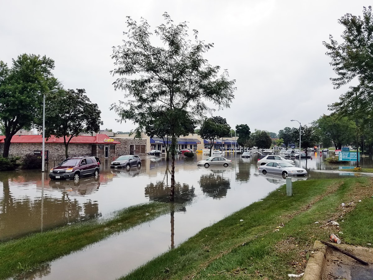
Does This Bangalore Property Flood? How to Check Before Buying

Quick answer: To check whether a Bengaluru property floods, ask neighbours about monsoon experience, check the site's elevation relative to the surrounding road and any nearby lake or stormwater drain, and look for water-stain marks on boundary walls from a visit during or just after heavy rain. Areas near Bellandur and other lake-adjacent zones warrant particular caution.
Published: 10 July 2026 | Updated: 1 August 2026 | By L K Monu Borkala, CEO & Founder, OneCity Property — 15 years of property consultancy experience and over 20 years in marketing and management at OneCity Technologies Pvt. Ltd.

Most of what gets written about flooding and Bangalore real estate comes from one of two places: a developer's own blog, or a general news roundup. Both have a problem. A developer writing about flood risk has an obvious reason to steer you away from the areas where their competitors have projects and toward wherever they happen to be building. A news roundup tells you what happened last monsoon but rarely tells you how to check a specific plot or flat yourself.
This is neither. Twenty years of doing transactions across this city means having no project of my own to sell you, and no reason to make one neighbourhood look worse than another except that it's true. Here's an honest look at where the real risk sits, and, more usefully, exactly how to check it yourself before you sign anything.
This matters more than it used to, because Bangalore's rainfall pattern itself has shifted. Rain now tends to arrive in shorter, more intense bursts rather than spread evenly across the monsoon, which floods the same drainage infrastructure faster than it was designed to handle, even in areas that coped fine a decade ago. That shift is exactly why relying on an area's older reputation, good or bad, is less reliable today than it used to be, and why a specific, current check matters more than ever.
Why Bangalore Floods Where It Never Used To
The short version is that the city grew faster than its drainage did. Bangalore's built-up area has gone from roughly 16 percent of the city in 1973 to more than 93 percent today, and a large share of that growth happened directly on top of what used to be lakes, tanks, and the natural stormwater channels connecting them. A widely cited Indian Institute of Science study found that close to 80 percent of Bangalore's flood-affected areas sit on former lake beds or blocked natural drainage paths.
Locals call these drainage channels rajakaluves. When they're encroached on, whether by a layout, a compound wall, or an entire building, water that used to have somewhere to go during heavy rain no longer does. It backs up, and the nearest low-lying road or basement becomes the new drainage channel instead. This is why some of the flooding in recent years has shown up in areas that were never historically considered flood-prone: the problem isn't the area's elevation, it's what got built over the water's original path.
BBMP itself has acknowledged that well over a thousand kilometres of stormwater drains across the city need desilting, widening, or rerouting. Until that backlog clears, meaningfully, the risk in the worst-affected stretches isn't going away on its own.
Efforts are underway to reverse some of this. Restoration work on lakes like Agara has shown that bringing a lake back to a functioning state reduces flooding in the surrounding stretch, and BBMP has used drone surveys in some zones to identify illegal construction over drains and lake beds. But restoration is slow, contested, and uneven across the city, which is exactly why a buyer today needs to check the specific site rather than assume the broader cleanup has already reached it.
Areas With Genuine, Documented Flood Risk
This list isn't a blanket judgment on any of these areas as a whole. Every one of them has pockets that are perfectly fine and pockets that flood every year, and the difference usually comes down to a specific stretch, a specific low point, or a specific layout's proximity to a blocked drain. But if you're looking at a property in any of these corridors, flood history deserves a specific, plot-level check rather than a general assumption that the area is fine because it's popular and expensive.
Bellandur has the most consistent flooding history of any major Bangalore tech corridor, tied directly to the condition of Bellandur Lake and the drains feeding it. Sarjapur Road, particularly the outer stretches, Whitefield, Mahadevapura, and the ORR stretch running past these areas have all seen serious waterlogging in recent monsoons, often at the same low-lying junctions repeatedly. HSR Layout, Koramangala, Marathahalli, Yemlur, and Hennur round out the list of areas with a documented pattern rather than a one-off bad year.
Again, none of this means don't buy here. It means treat flood history as a specific, checkable fact about the exact plot or block you're looking at, the same way you'd check title or Khata status, rather than something you assume based on the area's overall reputation.
Areas With a Better Track Record So Far
Vasanth Nagar, in central Bangalore, has a strong flood-resistance record tied to its elevation and older, better-maintained civic infrastructure. Hebbal and Yelahanka, particularly well-managed pockets like Kendriya Vihar, have seen a real drop in waterlogging complaints in recent years, credited partly to civic maintenance around key junctions. Jakkur and the stretch along Kanakapura Road toward Electronic City also show a comparatively stronger record, aided by better natural elevation in parts of that corridor.
A better track record so far is not a permanent guarantee, especially as construction continues to intensify in these areas too. But it is a useful data point when you're weighing two otherwise similar options.
What This Means for Specific Areas You Might Be Considering
If you're looking specifically at Bellandur, the lake and its surrounding drainage remain the single biggest variable, and it's worth checking the exact block's history before treating the area's overall popularity as a safety signal. Our guide to flats for sale in Bellandurcovers the area's investment fundamentals, and the flood-risk check above should sit alongside that, not instead of it.
HSR Layout and Koramangala are both established, well-regarded corridors with genuine demand independent of flood risk, but specific low-lying blocks within each have flooded repeatedly. Our guides to properties in HSR Layoutand properties in Koramangalaare good starting points, with the drain-proximity check above added on top before you commit to a specific block.
Marathahalli sits at a junction that has seen some of the ORR corridor's worst waterlogging in past monsoons, largely tied to drainage at specific road junctions rather than the area as a whole. Our Marathahalli apartments guidecovers the broader market, and the specific-block verification matters more here than in most corridors on this list.
Hebbal, by contrast, has one of the stronger track records among established corridors, aided by better elevation and more consistent civic maintenance. Our Hebbal real estate guideand Hebbal properties guidecover the area in more depth, and the flood-risk picture here is one of the more reassuring ones on this list, though a plot-level check is still worth the hour it takes.
Electronic City and the stretch toward Kanakapura Road round out the areas with a comparatively better record, aided by natural elevation in parts of the corridor. Our guides to plots in Electronic Cityand flats for sale in Electronic Citycover pricing and project options if this corridor is on your shortlist.
How Do You Actually Verify Flood Risk Before You Buy?
This is the part most guides skip, because it takes more effort than a paragraph telling you to "check before you buy" without saying how.
Pull the survey number's history through Karnataka's Bhoomi land records portal. Village and survey maps can show whether the specific parcel was historically a tank, lake bed, or marshland before it was developed, which is a far more reliable check than relying on how the finished layout looks today.
Cross-check with satellite and historical imagery through tools like Google Earth's historical view or ISRO's Bhuvan platform. Older satellite imagery from before an area was built up will often show the natural water bodies and drainage paths that a current-day site visit simply can't reveal.
Check proximity to rajakaluves and BBMP's stormwater drain network directly. Properties built within the legally mandated buffer zones around lakes, typically 75 metres, or directly on a stormwater drain alignment, carry real legal risk, not just flood risk: these are treated as encroachments and have faced BBMP demolition notices and NGT orders in the past.
Visit during or immediately after a heavy rain, not just on a dry, sunny weekend. This sounds obvious and gets skipped constantly. A dry-day visit tells you nothing about how the specific road, compound, or basement handles water.
Talk to residents who've actually lived through at least one monsoon there, not just the sales team. Existing residents in a layout or building will tell you, unprompted, whether the basement floods, whether the main road gets cut off, and how long it takes for water to recede.
Ask specifically about plinth height and site elevation relative to the surrounding road. A property built with a higher plinth on an elevated site handles the same rainfall very differently than one built at road level in a low-lying stretch, even within the same general neighbourhood.
What's Actually at Stake If You Ignore This
The risk isn't just inconvenience during monsoon season. Properties built within lake buffer zones or directly on stormwater drain alignments face genuine legal exposure, since these are treated as encroachments under NGT orders, with real demolition risk attached, not a hypothetical one.
The financial risk is just as real and shows up whether or not any demolition ever happens. Flood-affected localities have seen buyer inquiries and resale transactions drop by roughly 12 to 15 percent compared to unaffected areas, and price appreciation in these zones has slowed to under 3 percent a year, against 6 to 7 percent in comparable safer suburbs. In at least one documented case in Yelahanka, a property previously valued around two and a half crore rupees struggled to find a buyer even at two crore after a bad flooding season. Insurance costs are also climbing faster for flood-exposed properties, and lenders have started factoring flood history into how comfortably they approve loans in the worst-affected pockets.
None of this shows up in a brochure. It shows up two or three years later, when you're the one trying to sell.
What Flood Risk Does to Home Insurance and Loan Approval
Home insurance is still relatively underused in India compared to markets where it's standard, but that's changing fastest in exactly the areas with documented flood exposure. Insurers pricing flood-prone properties are starting to reflect the real claims history of specific pincodes and localities, which means a property in a repeatedly flood-affected block can carry a meaningfully higher premium than an equivalent property a few kilometres away with a cleaner record.
Lenders are moving in the same direction, more slowly but in the same direction. Some banks have begun factoring flood history into valuation and loan approval in the worst-affected pockets, which can show up as a lower loan-to-value ratio or additional scrutiny during the approval process. Neither of these costs is dramatic on its own, but both are worth asking about directly before you commit, rather than discovering them during the loan application itself.
A Note on Why Most of the Advice You'll Find Is Biased
It's worth being direct about this: a lot of the flood-safety content circulating right now comes from specific residential projects positioning their own location as the safe choice, in contrast to competing areas where they don't have anything to sell. That's not neutral advice, even when the individual facts cited happen to be accurate. Read anything on this topic, including this piece, with the seller's incentive in mind, and weight independently verifiable sources, survey records, satellite imagery, BBMP's own drain maps, actual resident experience, more heavily than anyone's marketing copy.
Checking This Remotely if You're Buying From Outside India
Every check above is harder to do properly from abroad, which is exactly why it matters more, not less, for NRI buyers. The Bhoomi portal and satellite imagery checks can be done remotely and don't require a site visit to complete. The resident-conversation and post-rain site visit cannot be outsourced to a brochure or a builder's photos, and skipping them is where remote buyers get burned most often.
If you have a trusted contact on the ground, whether family, a friend, or an independent advisor with no stake in the specific transaction, have them do the physical checks: visit after a heavy rain, talk to at least one existing resident, and photograph the site's actual elevation relative to the road. If you're earlier in the process and want the fuller picture on NRI-specific documentation and legal requirements, our NRI property buying guide covering FEMA, RERA, and e-Khatais worth reading alongside this one.
A Short Due Diligence Checklist
Pull the Bhoomi survey record for the specific parcel, not just the general area.
Check historical satellite imagery for the site before it was developed.
Confirm the property isn't within a lake buffer zone or built on a stormwater drain alignment.
Visit during or right after heavy rain, both on a dry day.
Talk to at least one current resident who has lived through a monsoon there.
Ask directly about plinth height and site elevation relative to the road.
Frequently Asked Questions
Which Bangalore areas have the worst documented flooding history?
Bellandur, Sarjapur Road's outer stretches, Whitefield, Mahadevapura, HSR Layout, Koramangala, Marathahalli, Yemlur, and Hennur have all seen repeated, documented waterlogging in recent monsoons, though risk varies significantly by specific stretch within each area.
Does flooding actually affect property value in Bangalore?
Yes. Flood-affected localities have shown price appreciation under 3 percent a year compared to 6 to 7 percent in safer suburbs, along with a 12 to 15 percent drop in buyer inquiries and resale transactions.
How can I check if a specific plot was built on a former lake or drain?
Pull the survey number's history through Karnataka's Bhoomi land records portal, and cross-check with historical satellite imagery through Google Earth or ISRO's Bhuvan platform, both of which can reveal water bodies and drainage paths that existed before the area was developed.
Is it illegal to build within a certain distance of a lake in Bangalore?
Yes. Construction within the mandated buffer zone around a lake, typically 75 metres, is treated as an encroachment under NGT orders and carries genuine demolition risk, separate from the practical flooding risk itself.
Should I avoid buying in a flood-prone area entirely?
Not necessarily. Risk varies by specific stretch even within known flood-prone corridors, and a property with a higher plinth, good elevation, and no proximity to a blocked drain can still be a reasonable choice. The point is to verify the specific plot rather than rely on the area's general reputation either way.
Twenty years of watching buyers make this decision has shown the same pattern again and again: the people who check plinth height, survey history, and drain proximity before buying rarely regret it, and the people who skip that step because the brochure looked good are the ones calling a lawyer two monsoons later. Spend the extra day on this checklist before you sign anything. It's cheaper than the alternative.
None of this needs to be complicated or expensive. Most of it costs a day of your time and a couple of hours online. Given what's actually at stake, that's a small price for the certainty it buys you.
Written by L K Monu Borkala
Featured Projects in This Area
Need expert property advice?
OneCity Property offers independent advisory across Bangalore, Mangalore and Mysore. Zero commission for buyers on projects under ₹1 Cr.
💬 WhatsApp Us📞 Call 076768 70876


News insight
 31/08/2026
What Homebuyers Should Look for in a Modern Apartment Security System
A guide to evaluating apartment security systems before buying, covering access control, cameras, pa...
 25/07/2026
Water Damage and Its Long-Term Impact on Property Value
Water damage can quietly slash a home's resale value. A look at why it happens, the real cost of ign...
 13/07/2026
Bangalore Property Dictionary: Every Term, Process, Measurement, Khata and Registration Rule Explained
The reference for Bangalore real estate in 2026: 60+ terms, Khata system, Bhu Guarantee deadline, me...